not much hobby related stuff was done in the past days, so luckily I got another historical post for you :D. Fear not - I have received my Warlord sprues today and I have already started working on some of them. I will show some conversions in my next post.
About two weeks ago, I went on a short trip to the battlefields around river Soča (pronounced "Socha", like Sochi, Russia). Or Isonzo, if you prefer. While this was merely a minor frontline in WW1, it is recognised as vitally important for Slovenes as a nation. Hence, our kids tend to know more about it than they know about western front - or any other for that matter.
When war broke out between Italy and A-H, the original plan was to defend the empire deeper inland, on rivers Sava and Drava (roughly where Ljubljana is, so middle of Slovenia by the eye). This would stretch Italian supply lines, wear down their army and give A-H army some place to maneuver. While this might be true, a large part of Slovene lands would be occupied and A-H troops would most probably destroy anything that Italians might use in their retreat towards river Sava and any further retreats towards Vienna if that would be necessary.
A Croat of Serbian origins, Field marshal Svetozar Borojević was offered the command of the newly formed army that was to defend the Italian border, but he insisted on altering the strategic plans and to make a stand in the hills around river Soča. Don't hold me for that, but I think the decision was made only a couple of days before Italians declared war. Mountainous terrain around Soča river was working in defender's favor, as the attackers had to assault up hill in order to gain control of the area.
Below is a map of the frontline as it was established in 1915. Soča front is that short vertical part of the front on the east. Blue areas show A-H territory that was occupied by Italian forces. If Soča would be left undefended, the blue area would continue east outside the map :P. Through out war, not much has happened on the northern part of this "Italian front", A-H troops launched an offensive in the west part that would, if successful, cut of Italian troops fighting around Isonzo and would lead to a complete destruction of the Italian army. The offensive was successful at first but was then canceled as Russians started offensive of their own on the Eastern front.

Italian offensives (there were 11 of those) were mostly concentrated on the south, with Gorica (pronounced Goritsa, Gorizia in Italian) and Trst (Trieste) as their main objectives. On the north, around Tolmin (Tolmino) and Kobarid (Caporetto), Central forces have launched their infamous offensive that drove Italian troops all the way to river Piave. As an interesting fact, this is where even Rommel himself fought.

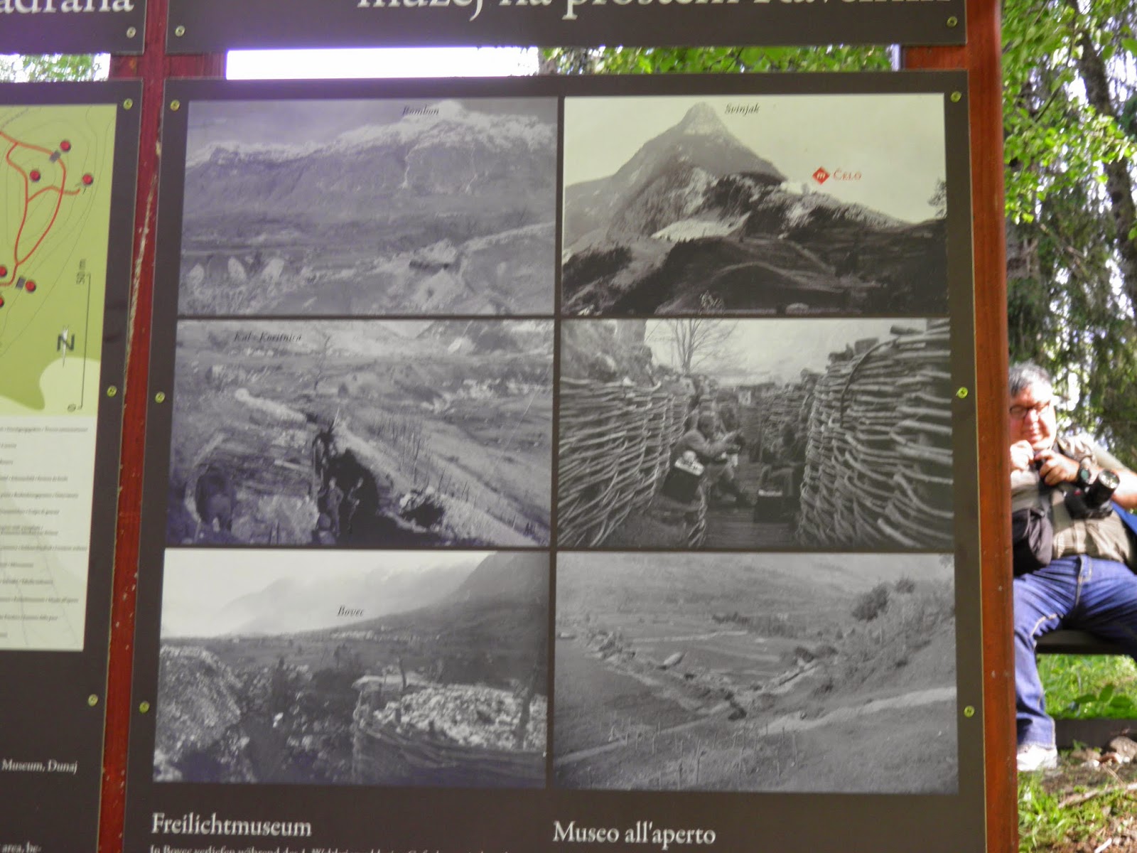
To continue from what I hope was an interesting, if not short introduction, here are some photos.
There's a random shot of Soča river. It's hands down my favorite river. One of the Narnia films was filmed in the area :D.


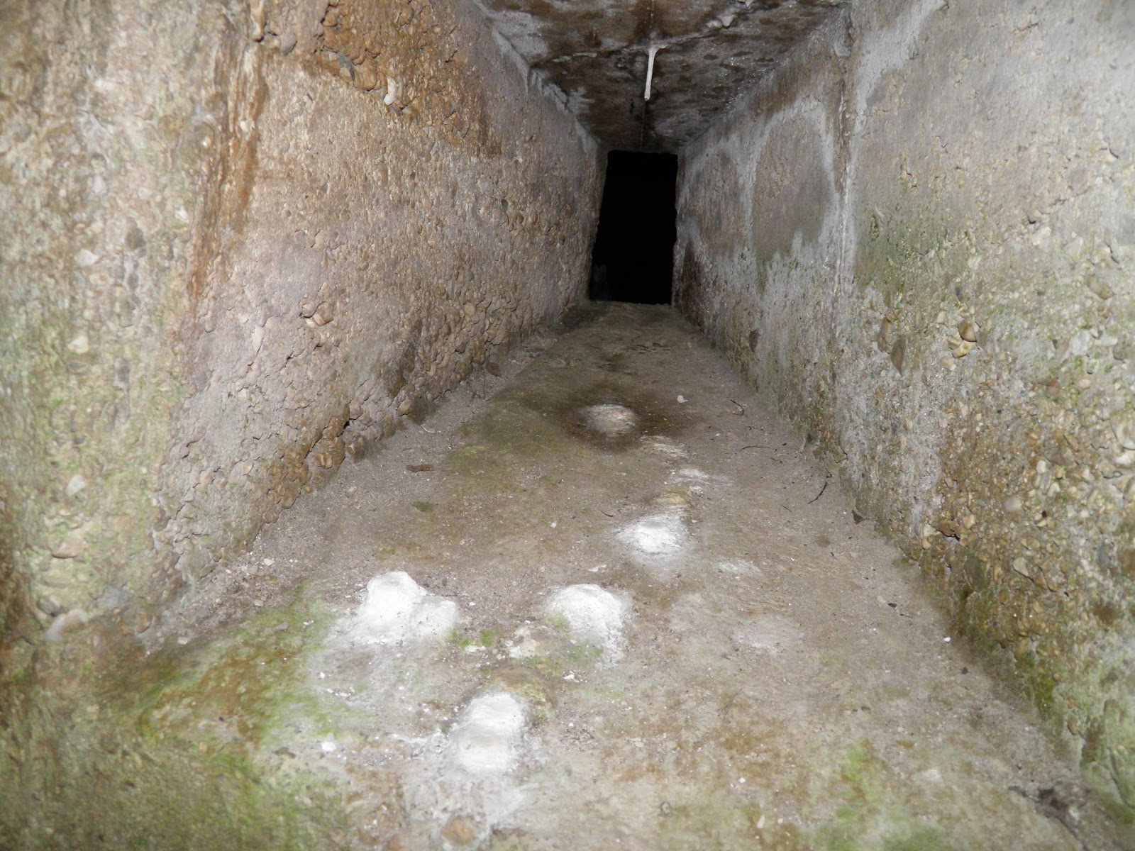


Below are remains of Austrian fort, that was destroyed by Napolen troops. It's commanding officer was Captain Johann Hermann and Fort Hermann was named after him.


Seeing we went too far north, we returned to Kluže fortress (can be seen below) and found a very small sign, explaining that Fort Hermann is located on the mountain above fort Kluže.

Fort Hermann must have impressed Italian, because they refused to enter the valley through a road that those two forts were defending. Fort Kluže was out of reach for Italian artillery, but Fort Hermann wasn't. I think over 2 thousand shells were fired in it's directions and some 300 hit their target.
Below are shots of the fort today:


Lastly, we visited Austro-Hungarian war cemetery. This one is dedicated to those that have fallen in the fights on mount Rombon.
The statue represents Austrian and Muslim soldiers. Bosniaks wore fezzes in A-H army. Fezzes are cool.


Aaand that's about it. I was hoping it would come out more interesting, but then again, many things appear better in my mind. I was trying to keep information basic, as copying texts from Wikipedia doesn't really help anyone :D.
Thanks for looking,
Mathyoo
You have a lot of historical sites within driving distance Mathyoo.
ReplyDeleteThese posts are really interesting, I for one had never heard of the stuff in this post or your other one about historical conflicts around you.
Top marks for teaching my dumbass some history dude.
Now get back to some painting ;-p
Hah, I'm well positioned :P.
DeleteI am glad they come useful - I can imagine you'd know (or care, really) about this front as much as I'd care about the naval blockade for example. It's all a matter of perspective.
A great history lesson and battlefield tour.
ReplyDeleteThere did seem to be a preponderance of domed roof, were these historical or later preservation additions ?
The River Soca looks a formidable obstacle too and the countryside is devoid of the hedgerows and walled enclosures that we see in Britain surrounding our fields.
Do you mean in the trenches? I was told the trenches are an "exact reconstruction", but with them being knees deep, it clearly isn't so :P. Corrugated metal roofing is probably historical, same sort was used in the Western front. I did forgot to mention that gas attack in the Caporetto offensive was set lose from those trenches (the one from the canisters) - the wind took it towards Italian positions around Bovec and they've suffered some 600 casualties. Quite a chilling thought.
DeleteAs for the walled enclosures, those are actually really common in the southern part, closer to the sea. It's arid and there's no surface water because of the limestone, so if they got anything they got stone. And prosciutto :D :D
It's sobering to think of how many people have fought and died over this area - and for how many centuries as well. That's some pretty rugged terrain; it must have been very hard on the troops, I think.
ReplyDeleteHah, yeah, it is "well positioned" - should be a very prosperous area in these days that everyone is friendly with each other :D.
DeleteThere are lots of books written about it, but unfortunately most probably not many in English, except about the last, Central powers' offensive. That's a hot topic. Italians were fierce, they launched 11 offensives and I've heard they rushed up the same hill over 20 times in one of the cases. Over and over again. Not that it was any different anywhere else, of course. WW1 is an odd conflicts, very "generalised" nowadays.
I will admit I did put of reading this to begin with but by the end I was wanting more! It's really great to see the country and the forts that make up this important front of WW1. I think each country only pays attention to it's own history as I know none of this was taught when I was at school.
ReplyDeleteAbsolutely brilliant post mate. Please feel free to do similar post in the future.
Amazing!
I am glad it was worth your time in the end :P. I really tried to shorten it as much as possible, but some sort of background introduction seemed fitting :).
DeleteI got one about Turkish invasions (16th century) that might interest you in my mind :P
Definitely worth the read in the end. Yes Turkish invasion would be good. I shall look forward to them.
DeleteThat is awesome that you live quite close to so much historical sites. I really should investigate my own area a bit more perhaps. The river is beautiful its so blue in colour.
ReplyDeleteThanks mate!
DeleteEngland might be a bit problematic for the modern era, as you guys are on the island, but there are still ECW and the Vikings :P
The river is stunning, right? A complete opposite of the muddy brown ones, really fantastic. Cold though, but still nice :D
Another insightful and interesting post, thanks buddy.
ReplyDeleteI'm glad it was interesting, thanks!
Delete